
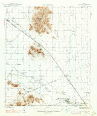
1947 Map of Red Rock
USGS Topo · Published 1947About this map
The Picacho Mountains rise sharply above the desert floor north of the Santa Cruz River, anchored by the prominent elevations of Newman Peak and Picacho Peak. This mid-century landscape reflects a diverse economy of ranching, military aviation, and early tourism, evidenced by the Picacho Peak Sahuaro Forest State Park and the extensive Marana Basic Flying School near the Pima and Pinal county line.
Find a feature on this map
41 named features on this map. Tap any name to fly to it.
Don’t see what you’re looking for? This feature index may not catch every label — zoom into the map to look around manually.
Map Details
Editions of this 1947 Red Rock Map
2 editions found
Other maps of this area

1922 · Red Rock No 2
USGS Topo · 1:48,000

1922 · Signal Peak
USGS Topo · 1:62,500

1924 · Signal Peak
USGS Topo · 1:62,500

1934 · Tucson Mountains
USGS Topo · 1:125,000

1934 · Silver Bell
USGS Topo · 1:125,000

1934 · Newman Peak
USGS Topo · 1:125,000

1947 · Cortaro
USGS Topo · 1:62,500

1947 · Eloy
USGS Topo · 1:62,500

1948 · Eloy
USGS Topo · 1:62,500

1956 · Tucson
USGS Topo · 1:250,000