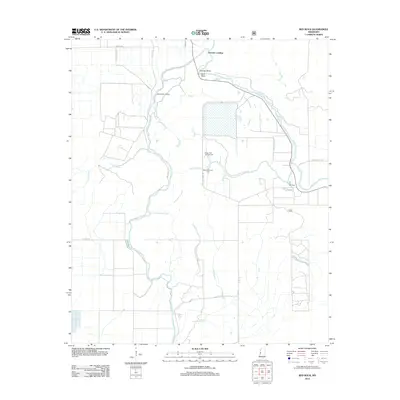
2012 Map of Red Rock
USGS Topo · Published 2012About this map
Choctaw Landing and Rolling Fork Landing stand as riverside points along the winding path of the Big Sunflower River in this part of Sharkey County. The landscape is defined by its hydraulic management, characterized by the Sunflower Greentree Reservoir and Long Bayou Greentree Reservoir, which dominate the central and southern portions of the map. These reservoirs, alongside numerous waterways like Howlett Bayou and the Little Sunflower River, illustrate the specialized land use required for timber and wildlife management in the Mississippi Delta.
Find a feature on this map
22 named features on this map. Tap any name to fly to it.
Don’t see what you’re looking for? This feature index may not catch every label — zoom into the map to look around manually.
Map Details
Editions of this 2012 Red Rock Map
This is the sole edition of this map. No revisions or reprints were ever made.
Other maps of this area

1939 · Onward
USGS Topo · 1:62,500

1939 · Lorenzen
USGS Topo · 1:62,500

1940 · Mechanicsburg
USGS Topo · 1:62,500

1955 · Jackson
USGS Topo · 1:250,000

1961 · Jackson
USGS Topo · 1:250,000

1961 · Bayland
USGS Topo · 1:62,500

1962 · Jackson
USGS Topo · 1:250,000

1963 · Mechanicsburg
USGS Topo · 1:62,500

1963 · Onward
USGS Topo · 1:62,500

1964 · Lorenzen
USGS Topo · 1:62,500