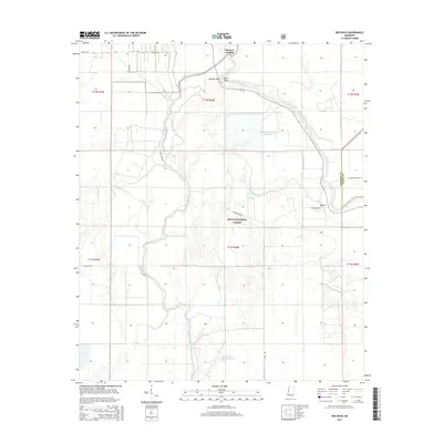
2015 Map of Red Rock
USGS Topo · Published 2015About this map
The Delta National Forest dominates this landscape in Sharkey County, defining a region where the Big Sunflower River and Little Sunflower River wind through a complex system of bottomlands. Small settlements such as Choctaw Landing and Red Rock sit near the riverbanks, marking the persistent human presence in this flood-prone environment. The importance of modern water management is evident in the presence of the Sunflower-Greentree Reservoir and the Long Bayou-Greentree Reservoir, which are designed to support local ecosystems and timber. Navigation through this wooded terrain is primarily facilitated by specialized routes like Fire Tower Rd and Oil Well RD, while natural landmarks like Buck Point and Cypress Bend serve as navigational markers for those on the water.
Find a feature on this map
24 named features on this map. Tap any name to fly to it.
Don’t see what you’re looking for? This feature index may not catch every label — zoom into the map to look around manually.
Map Details
Editions of this 2015 Red Rock Map
This is the sole edition of this map. No revisions or reprints were ever made.
Other maps of this area

1939 · Onward
USGS Topo · 1:62,500

1939 · Lorenzen
USGS Topo · 1:62,500

1940 · Mechanicsburg
USGS Topo · 1:62,500

1955 · Jackson
USGS Topo · 1:250,000

1961 · Jackson
USGS Topo · 1:250,000

1961 · Bayland
USGS Topo · 1:62,500

1962 · Jackson
USGS Topo · 1:250,000

1963 · Mechanicsburg
USGS Topo · 1:62,500

1963 · Onward
USGS Topo · 1:62,500

1964 · Lorenzen
USGS Topo · 1:62,500