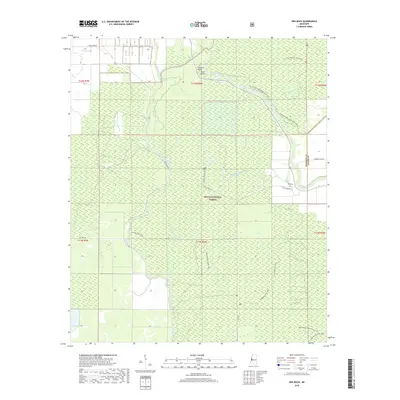
2018 Map of Red Rock
USGS Topo · Published 2018About this map
Delta National Forest covers much of this Mississippi landscape, dominated by the winding paths of the Big Sunflower River and Little Sunflower River. The river system creates a complex network of waterways, including Coon Bayou, Howlett Bayou, and the oxbow-like Cypress Bend. The small settlement of Red Rock sits at a junction of backcountry routes near the eastern boundary of Sharkey County and Yazoo County. This terrain is defined by its deep bottomland hydrology, where land features like Buck Point are shaped by the shifting currents of the Sunflower drainage. A series of forest roads and hiking paths, such as the Blue Lake Hiking Trail and the Spanish Fort Trail, provide the primary access through this dense wooded environment, reflecting the area's ongoing use for timber management and outdoor recreation.
Find a feature on this map
29 named features on this map. Tap any name to fly to it.
Don’t see what you’re looking for? This feature index may not catch every label — zoom into the map to look around manually.
Map Details
Editions of this 2018 Red Rock Map
This is the sole edition of this map. No revisions or reprints were ever made.
Other maps of this area

1939 · Onward
USGS Topo · 1:62,500

1939 · Lorenzen
USGS Topo · 1:62,500

1940 · Mechanicsburg
USGS Topo · 1:62,500

1955 · Jackson
USGS Topo · 1:250,000

1961 · Jackson
USGS Topo · 1:250,000

1961 · Bayland
USGS Topo · 1:62,500

1962 · Jackson
USGS Topo · 1:250,000

1963 · Mechanicsburg
USGS Topo · 1:62,500

1963 · Onward
USGS Topo · 1:62,500

1964 · Lorenzen
USGS Topo · 1:62,500