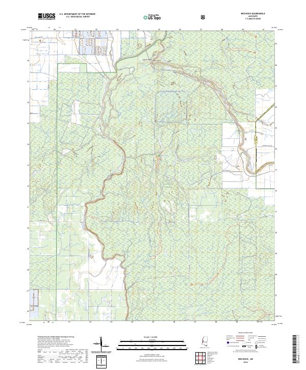
2024 Map of Red Rock
USGS Topo · Published 2024About this map
Delta National Forest dominates this section of the Mississippi Delta, revealing a landscape defined by its intricate hydrological network. The Big Sunflower River and Little Sunflower River meander through the terrain, accompanied by numerous oxbow remnants and wetlands such as Cypress Bend, Lost Lake, and Fish Lake. This 2024 survey captures the area's ongoing character as a managed wilderness, where the boundary between Sharkey Co and Yazoo Co is marked by the river's winding course.
Find a feature on this map
31 named features on this map. Tap any name to fly to it.
Don’t see what you’re looking for? This feature index may not catch every label — zoom into the map to look around manually.
Map Details
Editions of this 2024 Red Rock Map
This is the sole edition of this map. No revisions or reprints were ever made.
Other maps of this area

1939 · Onward
USGS Topo · 1:62,500

1939 · Lorenzen
USGS Topo · 1:62,500

1940 · Mechanicsburg
USGS Topo · 1:62,500

1955 · Jackson
USGS Topo · 1:250,000

1961 · Jackson
USGS Topo · 1:250,000

1961 · Bayland
USGS Topo · 1:62,500

1962 · Jackson
USGS Topo · 1:250,000

1963 · Mechanicsburg
USGS Topo · 1:62,500

1963 · Onward
USGS Topo · 1:62,500

1964 · Lorenzen
USGS Topo · 1:62,500