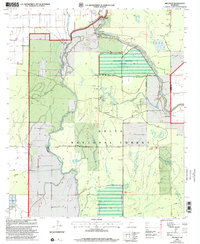
2000 Map of Red Rock
USGS Topo · Published 2002About this map
Delta National Forest dominates this landscape in Sharkey County, characterized by a complex network of wetlands and managed water levels. The presence of the Sunflower Greentree Reservoir and Long Bayou Greentree Reservoir indicates a sophisticated system of bottomland hardwood management, where levees and a Masonry Dam regulate seasonal flooding. Small settlements like Choctaw Landing and Red Rock anchor the edges of this riparian environment, while the meandering paths of the Big Sunflower River and Little Sunflower River define the local topography. This map captures the intersection of conservation and infrastructure at the millennium, featuring a Landing Strip and numerous Roads on Levee that provide access to remote areas like Cypress Bend and Barge Lake.
Find a feature on this map
25 named features on this map. Tap any name to fly to it.
Don’t see what you’re looking for? This feature index may not catch every label — zoom into the map to look around manually.
Map Details
Editions of this 2000 Red Rock Map
This is the sole edition of this map. No revisions or reprints were ever made.
Other maps of this area

1939 · Onward
USGS Topo · 1:62,500

1939 · Lorenzen
USGS Topo · 1:62,500

1940 · Mechanicsburg
USGS Topo · 1:62,500

1955 · Jackson
USGS Topo · 1:250,000

1961 · Jackson
USGS Topo · 1:250,000

1961 · Bayland
USGS Topo · 1:62,500

1962 · Jackson
USGS Topo · 1:250,000

1963 · Mechanicsburg
USGS Topo · 1:62,500

1963 · Onward
USGS Topo · 1:62,500

1964 · Lorenzen
USGS Topo · 1:62,500