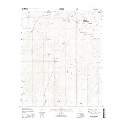
2014 Map of Red Top Mountain
USGS Topo · Published 2014About this map
The high plateau country of the Mogollon Plateau dominates this landscape, where the settlement of Linden sits at the northern edge of the Sitgreaves National Forest. The map documents a rugged drainage network defined by deep canyons and prominent ridges, including McCleve Canyon and Telephone Ridge. The reliance on local water management in this arid environment is evident through the numerous named tanks, such as Yellowjacket Tank and Middle Cottonwood Tank, which supported ranching and forestry operations in the early 21st century. The prominent Mogollon Rim Rd serves as a primary transit artery across the timbered uplands of Juniper Ridge. Notable landmarks like Red Top Mountain and Hop Mtn provide significant vertical relief against the complex system of draws and canyons, including the winding Yellowstone Canyon and Bagnal Draw.
Find a feature on this map
47 named features on this map. Tap any name to fly to it.
Don’t see what you’re looking for? This feature index may not catch every label — zoom into the map to look around manually.
Map Details
Editions of this 2014 Red Top Mountain Map
This is the sole edition of this map. No revisions or reprints were ever made.
Other maps of this area

1886 · Holbrook
USGS Topo · 1:250,000

1893 · Holbrook
USGS Topo · 1:250,000

1954 · Holbrook
USGS Topo · 1:250,000

1957 · Holbrook
USGS Topo · 1:250,000

1958 · Holbrook
USGS Topo · 1:250,000

1960 · Holbrook
USGS Topo · 1:250,000

1961 · Clay Springs
USGS Topo · 1:62,500
1961 · Show Low
USGS Topo · 1:62,500

1961 · Cibecue
USGS Topo · 1:62,500
1970 · Show Low North
USGS Topo · 1:24,000