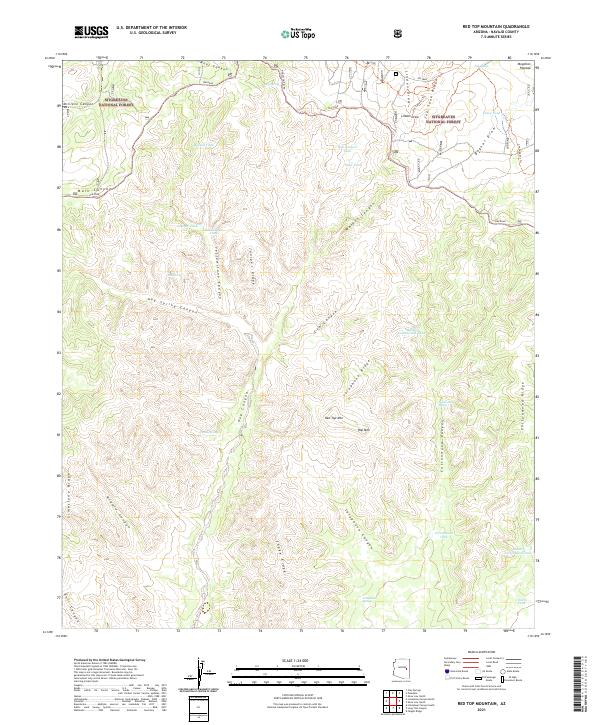
2021 Map of Red Top Mountain
USGS Topo · Published 2021About this map
Sitgreaves National Forest covers this section of the Mogollon Plateau, where the landscape is defined by a dense network of canyons and ridges. Water management is central to the area's utility, evidenced by numerous man-made tanks and natural springs such as Yellowstone Tank, Hop Spring, and Turkey Spring. These water sources are critical landmarks in a terrain carved by Yellowstone Canyon, Hog Spring Canyon, and Cottonwood Canyon. The elevation rises toward prominent high points including Red Top Mtn and Hop Mtn. Transportation through this complex topography relies on established routes like the Rim Road and the Mogollon Rim Rd, which follow the natural contours of the plateau edge. The map illustrates a landscape primarily shaped by forestry and livestock requirements, where named features often denote specific drainage basins and reliable water points for travelers and residents.
Find a feature on this map
59 named features on this map. Tap any name to fly to it.
Don’t see what you’re looking for? This feature index may not catch every label — zoom into the map to look around manually.
Map Details
Editions of this 2021 Red Top Mountain Map
This is the sole edition of this map. No revisions or reprints were ever made.
Other maps of this area

1886 · Holbrook
USGS Topo · 1:250,000

1893 · Holbrook
USGS Topo · 1:250,000

1954 · Holbrook
USGS Topo · 1:250,000

1957 · Holbrook
USGS Topo · 1:250,000

1958 · Holbrook
USGS Topo · 1:250,000

1960 · Holbrook
USGS Topo · 1:250,000

1961 · Clay Springs
USGS Topo · 1:62,500
1961 · Show Low
USGS Topo · 1:62,500

1961 · Cibecue
USGS Topo · 1:62,500
1970 · Show Low North
USGS Topo · 1:24,000