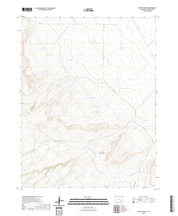
2022 Map of Red Top Ranch
USGS Topo · Published 2022About this map
Pueblo County's arid grazing lands and canyon country are meticulously detailed in this recent topographical study, which highlights a complex network of ranching infrastructure. The landscape is defined by its water management, featuring numerous catchments like Doyle Reservoir and the uniquely named Little Twin Dump Reservoir. Drainage systems such as Chicosa Cr and Peterson Cr carve through the terrain, leading toward deeper features like McElhaney Canyon and Myers Canyon. These canyons and the solitary rise of Cone Pinnacle provide the primary topographic relief in an area primarily used for large-scale ranching and land management.
Find a feature on this map
31 named features on this map. Tap any name to fly to it.
Don’t see what you’re looking for? This feature index may not catch every label — zoom into the map to look around manually.
Map Details
Editions of this 2022 Red Top Ranch Map
This is the sole edition of this map. No revisions or reprints were ever made.
Other maps of this area

1891 · Nepesta
USGS Topo · 1:125,000

1891 · Apishapa
USGS Topo · 1:125,000

1893 · Nepesta
USGS Topo · 1:125,000

1893 · Apishapa
USGS Topo · 1:125,000

1897 · Apishapa
USGS Topo · 1:125,000

1904 · Nepesta
USGS Topo · 1:125,000

1954 · Trinidad
USGS Topo · 1:250,000

1954 · Pueblo
USGS Topo · 1:250,000

1955 · Trinidad
USGS Topo · 1:250,000

1957 · Pueblo
USGS Topo · 1:250,000