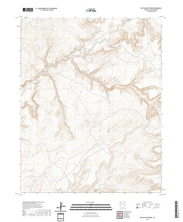
2021 Map of Red Willow Spring
USGS Topo · Published 2021About this map
Red Willow Spring sits within a high-altitude drainage landscape of Navajo County, reflecting the critical importance of water sources in this arid northern Arizona territory. The terrain is defined by the winding course of Moenkopi Wash and the complex topography of White Ruin Canyon, which cuts across the southern sections of the township. These named water features and canyons are significant markers for land management and local navigation in a region characterized by the Public Land Survey System grids of t34n r16e, t34n r17e, t33n r16e, and t33n r17e. The map illustrates a remote environment where reliable hydrology like Cottonwood Spring serves as a primary geographic anchor. The concentration of springs and named washes indicates a landscape shaped more by natural drainage patterns and the availability of water than by dense human settlement.
Find a feature on this map
8 named features on this map. Tap any name to fly to it.
Don’t see what you’re looking for? This feature index may not catch every label — zoom into the map to look around manually.
Map Details
Editions of this 2021 Red Willow Spring Map
This is the sole edition of this map. No revisions or reprints were ever made.
Other maps of this area

1883 · Marsh Pass
USGS Topo · 1:250,000

1892 · Marsh Pass
USGS Topo · 1:250,000

1956 · Marble Canyon
USGS Topo · 1:250,000

1959 · Marble Canyon
USGS Topo · 1:250,000

1961 · Marble Canyon
USGS Topo · 1:250,000
1967 · Big Mountain Dam
USGS Topo · 1:24,000
1967 · Rocky Ridge NW
USGS Topo · 1:24,000
1967 · Rocky Ridge NE
USGS Topo · 1:24,000
1968 · Owl Valley
USGS Topo · 1:24,000
1970 · Kydestea Spring
USGS Topo · 1:24,000