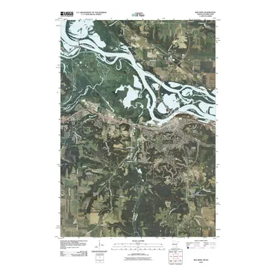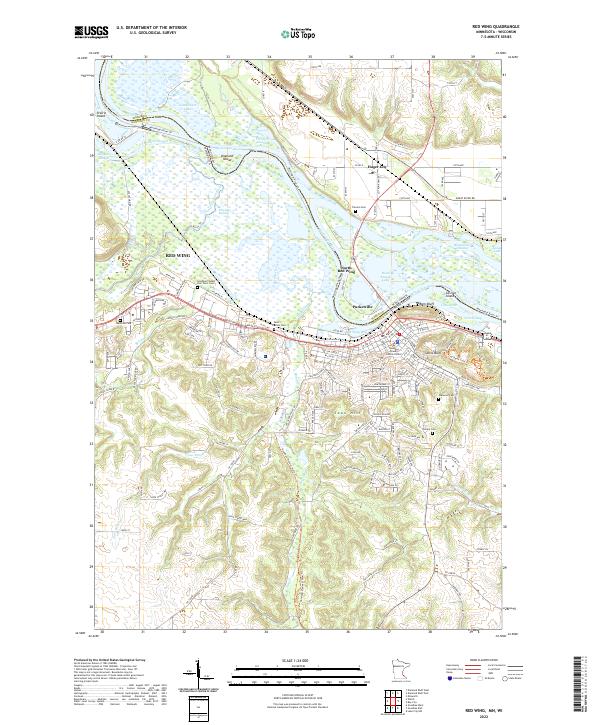
2022 Map of Red Wing
USGS Topo · Published 2022About this map
The Mississippi River serves as the defining border between Minnesota and Wisconsin in this 2022 survey, with the city of Red Wing anchored on its western banks. The map documents a complex riparian landscape of sloughs and islands, including Diamond Island and Carlson Island, framed by the dramatic heights of Sorins Bluff and Coon Hill. This area is characterized by its transition from the flat river bottoms of Rice Lake Bottoms to the uplifted bluffs that overlook the valley.
Find a feature on this map
102 named features on this map. Tap any name to fly to it.
Don’t see what you’re looking for? This feature index may not catch every label — zoom into the map to look around manually.
Map Details
Editions of this 2022 Red Wing Map
This is the sole edition of this map. No revisions or reprints were ever made.
Historical Maps of Red Wing Through Time
8 maps found