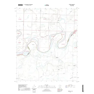
2019 Map of Redbank
USGS Topo · Published 2019About this map
The Red River defines the winding border between Arkansas and Texas in this region where Bowie County and Little River County meet. The landscape is dominated by the river's serpentine path and the remnants of its former courses, seen in features like the large oxbow of Hudson Bow and numerous wetlands such as LaVoice Lake and Hudson Lake. The low-lying terrain of Black Bottom south of the river is punctuated by small settlements like Burns and Smith Hill, which sit amidst a network of county roads including FM 560 and FM 1398. Local history is anchored by sites like Red Oak Grove Cem and Hughes Cem, while the northern portion of the map shows the influence of the Little River through drainage features like Crooked Slough and Walnut Bayou.
Find a feature on this map
55 named features on this map. Tap any name to fly to it.
Don’t see what you’re looking for? This feature index may not catch every label — zoom into the map to look around manually.
Map Details
Editions of this 2019 Redbank Map
This is the sole edition of this map. No revisions or reprints were ever made.
Other maps of this area

1909 · New Boston
USGS Topo · 1:62,500

1909 · Texarkana
USGS Topo · 1:62,500

1950 · Redbank
USGS Topo · 1:24,000

1950 · Ashdown West
USGS Topo · 1:24,000

1950 · Barkman
USGS Topo · 1:24,000

1951 · Redbank
USGS Topo · 1:24,000

1951 · Ashdown West
USGS Topo · 1:24,000

1951 · Barkman
USGS Topo · 1:24,000

1951 · Arden
USGS Topo · 1:24,000

1951 · Foreman
USGS Topo · 1:24,000