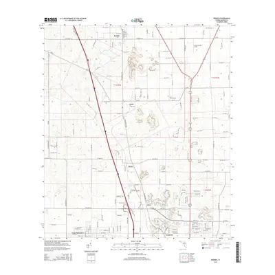
2015 Map of Reddick
USGS Topo · Published 2015About this map
Reddick stands as a primary focal point in this 2015 survey of northern Marion County, where the landscape is defined by its small crossroads settlements and agricultural aviation sites. The terrain is marked by numerous sinkholes and depressions characteristic of north-central Florida's karst topography, stretching between Lowell and Martin. Local genealogy and land use patterns are anchored by features like Union Cem near the junction of north-south corridors. Small-scale aviation plays a visible role in the local economy, represented by both Lee Farms Airport and the descriptively named Wings-n-Wheels Airport. As the map moves south toward Zuber and Kendrick, the transition into the outskirts of more developed residential areas like Ocala Park Ranch becomes evident, illustrating the gradual shift from rural farmland to suburban expansion in the early 21st century.
Find a feature on this map
70 named features on this map. Tap any name to fly to it.
Don’t see what you’re looking for? This feature index may not catch every label — zoom into the map to look around manually.
Map Details
Editions of this 2015 Reddick Map
This is the sole edition of this map. No revisions or reprints were ever made.
Other maps of this area

1892 · Dunnellon
USGS Topo · 1:62,500

1893 · Citra
USGS Topo · 1:62,500

1894 · Dunnellon
USGS Topo · 1:62,500

1895 · Williston
USGS Topo · 1:62,500

1895 · Citra
USGS Topo · 1:62,500

1895 · Ocala
USGS Topo · 1:62,500

1954 · Cotton Plant
USGS Topo · 1:24,000

1954 · Dunnellon
USGS Topo · 1:62,500

1954 · Gainesville
USGS Topo · 1:250,000

1958 · Gainesville
USGS Topo · 1:250,000