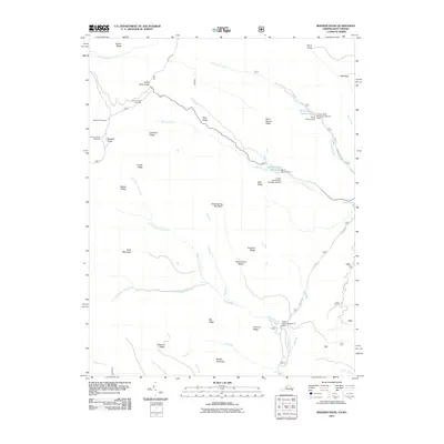
2011 Map of Reddish Knob
USGS Topo · Published 2011About this map
Reddish Knob stands as a prominent high point along the Appalachian crest, anchoring a landscape defined by significant water management infrastructure and high-elevation viewpoints. The 2011 topography reveals a complex network of dams designed for flood control and water storage, including the Hone Quarry Dam and the Briery Branch Dam, which create the Hone Quarry Reservoir and Briery Branch Reservoir respectively. These engineered features are integrated into the drainage basins of the North Fork Little River and South Fork Little River.
Find a feature on this map
47 named features on this map. Tap any name to fly to it.
Don’t see what you’re looking for? This feature index may not catch every label — zoom into the map to look around manually.
Map Details
Editions of this 2011 Reddish Knob Map
This is the sole edition of this map. No revisions or reprints were ever made.
Other maps of this area

1892 · Franklin
USGS Topo · 1:125,000

1894 · Staunton
USGS Topo · 1:125,000

1896 · Franklin
USGS Topo · 1:125,000

1922 · Fort Seybert
USGS Topo · 1:48,000

1922 · Circleville
USGS Topo · 1:62,500

1924 · Circleville
USGS Topo · 1:48,000

1924 · Mc Dowell
USGS Topo · 1:62,500

1924 · Fort Seybert
USGS Topo · 1:62,500

1944 · Parnassus
USGS Topo · 1:62,500

1944 · Mc Dowell
USGS Topo · 1:62,500