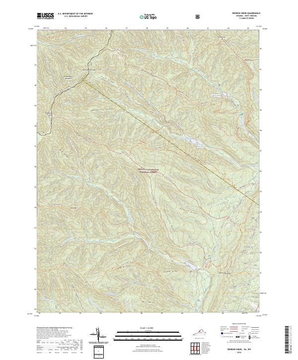
2022 Map of Reddish Knob
USGS Topo · Published 2022About this map
Shenandoah Mountain forms the centerpiece of this high-elevation survey, marking the political boundary between Virginia and West Virginia. This terrain, preserved within the George Washington National Forest, is defined by a dense network of water systems including Little River, Hone Quarry Run, and Skidmore Fork. The map documents a landscape of dramatic verticality, from the namesake peak at Reddish Knob to the deep contours of Dunkard Ridge and California Ridge. Managed water features such as Hone Quarry Reservoir and Hearthstone Lake punctuate the drainage basins. Long-established travel routes like Briery Branch Road and the Timber Ridge Trail follow the natural geography of the ridges, illustrating how the area's crests and gaps have dictated movement through the mountain passes for generations.
Find a feature on this map
66 named features on this map. Tap any name to fly to it.
Don’t see what you’re looking for? This feature index may not catch every label — zoom into the map to look around manually.
Map Details
Editions of this 2022 Reddish Knob Map
This is the sole edition of this map. No revisions or reprints were ever made.
Other maps of this area

1892 · Franklin
USGS Topo · 1:125,000

1894 · Staunton
USGS Topo · 1:125,000

1896 · Franklin
USGS Topo · 1:125,000

1922 · Fort Seybert
USGS Topo · 1:48,000

1922 · Circleville
USGS Topo · 1:62,500

1924 · Circleville
USGS Topo · 1:48,000

1924 · Mc Dowell
USGS Topo · 1:62,500

1924 · Fort Seybert
USGS Topo · 1:62,500

1944 · Parnassus
USGS Topo · 1:62,500

1944 · Mc Dowell
USGS Topo · 1:62,500