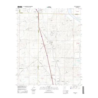
2014 Map of Redfield
USGS Topo · Published 2014About this map
The Arkansas River carves the eastern boundary of this Jefferson County landscape, where the town of Redfield serves as a central hub along the rail and highway corridor. The terrain transitions from the low-lying wetlands of Harris Bayou and Campbell Bayou in the north to the distinctive elevations of Counterfeit Ridge and the Harris Mountains. Local history is anchored by several long-standing community markers, including the Redfield Cem, Jefferson Cem, and the uniquely named Rest in Peace Memorial Gardens. Small settlements such as Kearney, English Place, and Jefferson are connected by a network of rural routes like Mail Route Rd and Stagecoach Rd, reflecting a settlement pattern tied to the historic transit lines and the drainage basins of Simpson Cr and Love Cr.
Find a feature on this map
108 named features on this map. Tap any name to fly to it.
Don’t see what you’re looking for? This feature index may not catch every label — zoom into the map to look around manually.
Map Details
Editions of this 2014 Redfield Map
This is the sole edition of this map. No revisions or reprints were ever made.
Other maps of this area

1891 · Little Rock
USGS Topo · 1:125,000

1893 · Little Rock
USGS Topo · 1:125,000

1932 · Pastoria
USGS Topo · 1:62,500

1935 · Alexander
USGS Topo · 1:48,000

1935 · Pastoria
USGS Topo · 1:62,500

1939 · Keo
USGS Topo · 1:31,680

1940 · Woodson
USGS Topo · 1:31,680

1941 · Alexander
USGS Topo · 1:62,500

1941 · Keo
USGS Topo · 1:31,680

1944 · Spring Lake
USGS Topo · 1:31,680