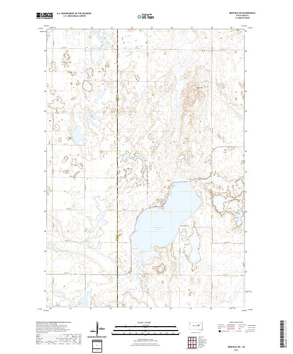
2021 Map of Redfield SW
USGS Topo · Published 2021About this map
Cottonwood Lake dominates the central landscape of this rural prairie region, serving as a primary hydrologic landmark for the surrounding townships. The area is defined by a strictly organized section line grid of roads, including 174th St and 182nd St, which partition the agricultural terrain. Running along the western side of the lake, Lake Dr and Cottonwood Ln suggest a cluster of localized settlement or recreation. The topography is marked by notable elevations such as Bald Mtn to the north and the winding drainage of Medicine Creek (also labeled as Medicine Cr) flowing through the southwestern sections. This map also preserves the administrative boundary between Hand and Spink counties, showing how this jurisdictional line bisects the various parcels and waterways of the South Dakota plains.
Find a feature on this map
29 named features on this map. Tap any name to fly to it.
Don’t see what you’re looking for? This feature index may not catch every label — zoom into the map to look around manually.
Map Details
Editions of this 2021 Redfield SW Map
This is the sole edition of this map. No revisions or reprints were ever made.
Other maps of this area

1899 · Redfield
USGS Topo · 1:125,000

1953 · Redfield North
USGS Topo · 1:24,000

1953 · Huron
USGS Topo · 1:250,000

1954 · Huron
USGS Topo · 1:250,000

1966 · Burdette
USGS Topo · 1:24,000

1966 · Redfield South
USGS Topo · 1:24,000
1966 · Rockham
USGS Topo · 1:24,000
1966 · Rockham SE
USGS Topo · 1:24,000
1966 · Zell
USGS Topo · 1:24,000

1966 · Redfield SW
USGS Topo · 1:24,000