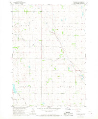
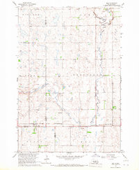
1966 Map of Rockham SE
USGS Topo · Published 1967About this map
Medicine Creek winds through the expansive prairie of Hand County during the mid-1960s, a period when this section of the Missouri River Basin was actively being surveyed for reclamation development. The landscape is defined by its rural civic organization, divided into distinct townships such as Linn, Plato, Carlton, and Wheaton. These boundaries reveal a settled agricultural grid where community life centered around small hubs like the Wheaton Ch and the nearby Center Sch.
Find a feature on this map
14 named features on this map. Tap any name to fly to it.
Don’t see what you’re looking for? This feature index may not catch every label — zoom into the map to look around manually.
Map Details
Editions of this 1966 Rockham SE Map
This is the sole edition of this map. No revisions or reprints were ever made.
Other maps of this area

1899 · Redfield
USGS Topo · 1:125,000

1953 · Huron
USGS Topo · 1:250,000

1954 · Huron
USGS Topo · 1:250,000

1966 · Burdette
USGS Topo · 1:24,000
1966 · Miranda
USGS Topo · 1:24,000
1966 · Rockham SW
USGS Topo · 1:24,000
1966 · Rockham
USGS Topo · 1:24,000
1966 · Zell
USGS Topo · 1:24,000

1966 · Redfield SW
USGS Topo · 1:24,000

1967 · Tulare NW
USGS Topo · 1:24,000