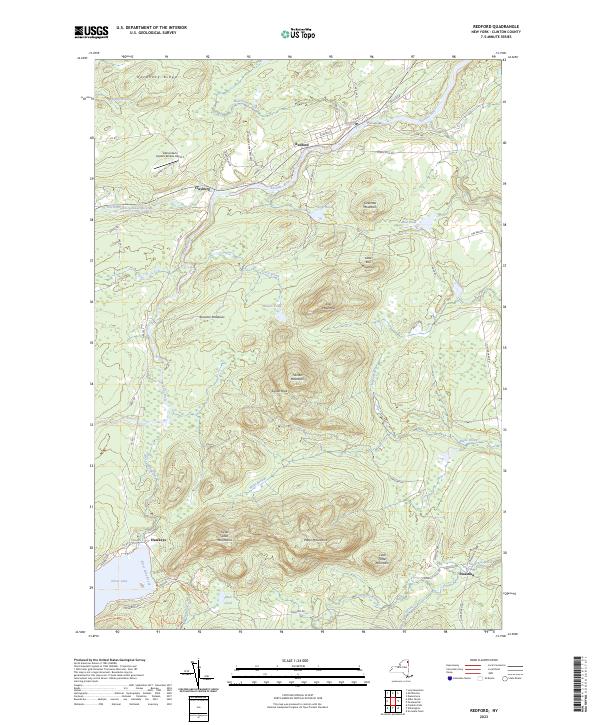
2023 Map of Redford
USGS Topo · Published 2023About this map
The Saranac River and its North Branch dictate the settlement patterns of this Clinton County landscape, winding past the hamlets of Redford and Clayburg. This modern survey illustrates the enduring interface between small Adirondack communities and the surrounding Adirondack Park Preserve. To the south, the terrain rises sharply into the Silver Lake Mountains and Potter Mountains, punctuated by landmarks like Signal Peak and Tolman Mountain. Recreational access is a prominent theme here, with detailed mapping of the Silver Lake Mtn Trl, Douglas Mountain Loop-4-Trl, and Taylor Pond Loop Trl. Further north, the Adirondack Airpark Estates Airport represents more recent development alongside traditional features like Ore Pond and Hardhack Ridge. The map also documents the localized road network, including the aptly named Guide Board Rd and Turnpike Rd.
Find a feature on this map
62 named features on this map. Tap any name to fly to it.
Don’t see what you’re looking for? This feature index may not catch every label — zoom into the map to look around manually.
Map Details
Editions of this 2023 Redford Map
This is the sole edition of this map. No revisions or reprints were ever made.
Other maps of this area

1895 · Ausable
USGS Topo · 1:62,500

1896 · Lake Placid
USGS Topo · 1:62,500

1898 · Lake Placid
USGS Topo · 1:62,500

1903 · Ausable
USGS Topo · 1:62,500

1911 · Lyon Mountain
USGS Topo · 1:62,500

1913 · Dannemora
USGS Topo · 1:62,500

1913 · Lyon Mountain
USGS Topo · 1:62,500

1931 · Lyon Mountain
USGS Topo · 1:62,500

1950 · Lake Champlain
USGS Topo · 1:250,000

1953 · Lake Placid
USGS Topo · 1:62,500