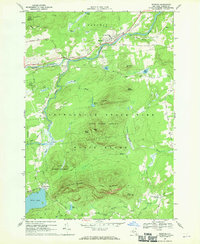
1968 Map of Redford
USGS Topo · Published 1970About this map
The Saranac River carves through this northern landscape, anchoring the settlements of Redford and Clayburg during the late 1960s. The village of Redford is marked by the Assumption of Mary Ch and a nearby Cem, reflecting its role as a local community center. The terrain is defined by high peaks and ridges, including Signal Peak, Tolman Mtn, and the Silver Lake Mountains, which create a natural barrier between the river valley and the basins to the south.
Find a feature on this map
45 named features on this map. Tap any name to fly to it.
Don’t see what you’re looking for? This feature index may not catch every label — zoom into the map to look around manually.
Map Details
Editions of this 1968 Redford Map
This is the sole edition of this map. No revisions or reprints were ever made.
Other maps of this area

1895 · Ausable
USGS Topo · 1:62,500

1896 · Lake Placid
USGS Topo · 1:62,500

1898 · Lake Placid
USGS Topo · 1:62,500

1903 · Ausable
USGS Topo · 1:62,500

1911 · Lyon Mountain
USGS Topo · 1:62,500

1913 · Dannemora
USGS Topo · 1:62,500

1913 · Lyon Mountain
USGS Topo · 1:62,500

1931 · Lyon Mountain
USGS Topo · 1:62,500

1950 · Lake Champlain
USGS Topo · 1:250,000

1953 · Lake Placid
USGS Topo · 1:62,500