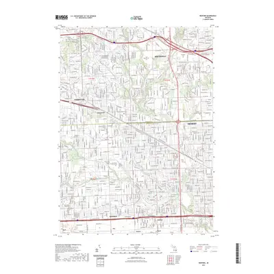
2023 Map of Redford
USGS Topo · Published 2023About this map
Southfield and Livonia anchor this detailed study of northwestern Detroit's suburban landscape. The survey captures the dense residential grid established around major thoroughfares like W 8 Mile RD and the Northwestern HWY, marking the intersection of Oakland Co and Wayne Co. Significant genealogical resources are documented throughout the area, including the sprawling Holy Sepulchre Cem and the older Pioneer Cem near the northern edge.
Find a feature on this map
49 named features on this map. Tap any name to fly to it.
Don’t see what you’re looking for? This feature index may not catch every label — zoom into the map to look around manually.
Map Details
Editions of this 2023 Redford Map
This is the sole edition of this map. No revisions or reprints were ever made.
Other maps of this area

1905 · Wayne
USGS Topo · 1:62,500

1905 · Detroit
USGS Topo · 1:62,500

1907 · Pontiac
USGS Topo · 1:62,500

1908 · Rochester
USGS Topo · 1:62,500

1912 · Wayne
USGS Topo · 1:62,500

1918 · Detroit
USGS Topo · 1:62,500

1924 · Detroit
USGS Topo · 1:62,500

1934 · Detroit
USGS Topo · 1:62,500

1936 · Inkster
USGS Topo · 1:31,680

1936 · Wayne
USGS Topo · 1:31,680