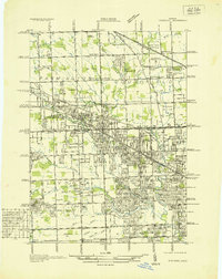
1936 Map of Redford
USGS Topo · Published 1936About this map
The Rouge River and its various tributaries like Pebble Creek and Tarabusi Creek define the landscape of this northwestern Detroit suburban frontier in the mid-1930s. The map illustrates a transitional period where large agricultural tracts in Livonia and Farmington are being segmented by early twentieth-century residential developments, including the Westmore Subdivision and Grand River Oaks Subdivision. A dense network of grid-patterned roads, named from Twelve Mile Rd down to Schoolcraft Ave, frames the growth of Clarenceville and Southfield Center. Notably, the area is rich with institutional landmarks and community centers of the era, such as the Childrens Hospital of Mich (Convalescent Home) and the Methodist Children Home Society. These features, alongside numerous local schools like Beech Rd Sch and Hettie Bristol Sch, reflect a burgeoning residential community established before the post-war suburban explosion.
Find a feature on this map
98 named features on this map. Tap any name to fly to it.
Don’t see what you’re looking for? This feature index may not catch every label — zoom into the map to look around manually.
Map Details
Editions of this 1936 Redford Map
This is the sole edition of this map. No revisions or reprints were ever made.
Other maps of this area

1905 · Wayne
USGS Topo · 1:62,500

1905 · Detroit
USGS Topo · 1:62,500

1907 · Pontiac
USGS Topo · 1:62,500

1908 · Rochester
USGS Topo · 1:62,500

1912 · Wayne
USGS Topo · 1:62,500

1918 · Detroit
USGS Topo · 1:62,500

1924 · Detroit
USGS Topo · 1:62,500

1934 · Detroit
USGS Topo · 1:62,500

1936 · Inkster
USGS Topo · 1:31,680

1936 · Wayne
USGS Topo · 1:31,680