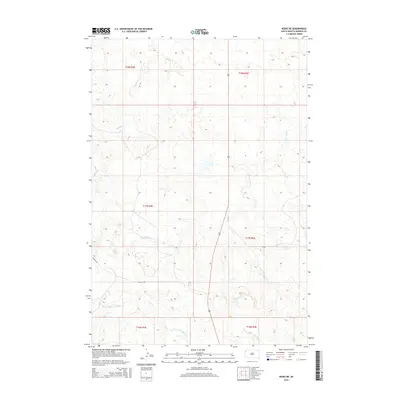
2015 Map of Redig NE
USGS Topo · Published 2015About this map
The N Fork Moreau River traverses the southern expanse of this Harding County landscape, defining the local hydrology alongside its various tributaries. This portion of the High Plains is characterized by the meandering paths of Buffalo Creek and Clarks Fork Creek, which cut through the terrain to shape the drainage patterns of the region. The map reveals a sparse network of rural transit, notably Mackey Rd and JB Rd, which serve as the primary conduits through the open grazing lands and undulating topography. In the southeastern corner, the headwaters of Duck Creek and its southern branch, S Br Duck Creek, further emphasize the importance of water management and natural drainage in this western South Dakota prairie environment.
Find a feature on this map
13 named features on this map. Tap any name to fly to it.
Don’t see what you’re looking for? This feature index may not catch every label — zoom into the map to look around manually.
Map Details
Editions of this 2015 Redig NE Map
This is the sole edition of this map. No revisions or reprints were ever made.
Other maps of this area

1935 · Reva
USGS Topo · 1:125,000

1935 · Hoover
USGS Topo · 1:125,000

1935 · Harding
USGS Topo · 1:125,000

1935 · Buffalo
USGS Topo · 1:125,000

1954 · Lemmon
USGS Topo · 1:250,000

1957 · Lemmon
USGS Topo · 1:250,000

1971 · Buffalo
USGS Topo · 1:24,000
1971 · Sheep Pen Draw SW
USGS Topo · 1:24,000

1971 · Saddle Butte
USGS Topo · 1:24,000

1973 · Bog Creek
USGS Topo · 1:24,000