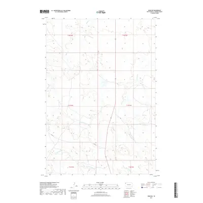
2017 Map of Redig NE
USGS Topo · Published 2017About this map
The N Fork Moreau River meanders through the southern reaches of this Harding County landscape, defining the local drainage patterns alongside tributaries like Clarks Fork Cr. This high-plains region of South Dakota is characterized by its expansive grazing lands and a sparse network of rural routes, including Mackey Rd and J B Rd, which connect isolated ranching sections. The terrain is marked by significant hydrological features such as Buffalo Cr in the north and the headwaters of Duck Cr and S Br Duck Cr in the southeast. Land ownership and management are delineated by the township and range grid, showing transitions between areas like t17n r4e and t17n r5e. The map reflects a remote, working landscape where water sources and section-line roads remain the primary landmarks for navigation and land use.
Find a feature on this map
13 named features on this map. Tap any name to fly to it.
Don’t see what you’re looking for? This feature index may not catch every label — zoom into the map to look around manually.
Map Details
Editions of this 2017 Redig NE Map
This is the sole edition of this map. No revisions or reprints were ever made.
Other maps of this area

1935 · Reva
USGS Topo · 1:125,000

1935 · Hoover
USGS Topo · 1:125,000

1935 · Harding
USGS Topo · 1:125,000

1935 · Buffalo
USGS Topo · 1:125,000

1954 · Lemmon
USGS Topo · 1:250,000

1957 · Lemmon
USGS Topo · 1:250,000

1971 · Buffalo
USGS Topo · 1:24,000
1971 · Sheep Pen Draw SW
USGS Topo · 1:24,000

1971 · Saddle Butte
USGS Topo · 1:24,000

1973 · Bog Creek
USGS Topo · 1:24,000