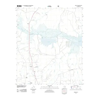
2010 Map of Redland
USGS Topo · Published 2010About this map
The Angelina River and its associated lowlands dominate this East Texas landscape north of Lufkin, where water management and rural settlements define the local geography. Significant hydraulic features like Lake Kurth, held by the Kurth Dam, and the western reaches of the Sam Rayburn Reservoir highlight the regional reliance on these man-made water bodies. The terrain is marked by numerous drainage systems including Alazan Bayou, Bayou La Nana, and Mill Creek, which weave through the wooded bottomlands near Lower Island.
Find a feature on this map
51 named features on this map. Tap any name to fly to it.
Don’t see what you’re looking for? This feature index may not catch every label — zoom into the map to look around manually.
Map Details
Editions of this 2010 Redland Map
This is the sole edition of this map. No revisions or reprints were ever made.
Other maps of this area

1949 · Lufkin
USGS Topo · 1:62,500

1949 · Platt
USGS Topo · 1:24,000

1949 · Clawson
USGS Topo · 1:24,000

1949 · Lufkin
USGS Topo · 1:24,000

1949 · Huntington
USGS Topo · 1:24,000

1949 · Keltys
USGS Topo · 1:24,000

1950 · Platt
USGS Topo · 1:24,000

1950 · Keltys
USGS Topo · 1:24,000

1950 · Lufkin
USGS Topo · 1:24,000

1950 · Clawson
USGS Topo · 1:24,000