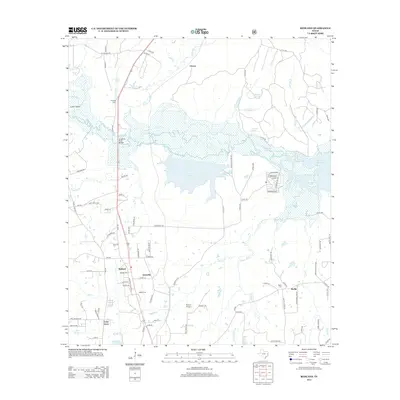
2013 Map of Redland
USGS Topo · Published 2013About this map
The Angelina River corridor defines this portion of East Texas, where low-lying bottomlands and creeks meet the expanding footprints of small communities north of Lufkin. The river’s course, including the Angelina River Bridge, is surrounded by a complex network of bayous such as Alazan Bayou, Black Bayou, and Bayou La Nana. This landscape reflects a mix of natural waterways and modern infrastructure, including the large expanse of Lake Kurth and the western edge of the Sam Rayburn Reservoir.
Find a feature on this map
105 named features on this map. Tap any name to fly to it.
Don’t see what you’re looking for? This feature index may not catch every label — zoom into the map to look around manually.
Map Details
Editions of this 2013 Redland Map
This is the sole edition of this map. No revisions or reprints were ever made.
Other maps of this area

1949 · Lufkin
USGS Topo · 1:62,500

1949 · Platt
USGS Topo · 1:24,000

1949 · Clawson
USGS Topo · 1:24,000

1949 · Lufkin
USGS Topo · 1:24,000

1949 · Huntington
USGS Topo · 1:24,000

1949 · Keltys
USGS Topo · 1:24,000

1950 · Platt
USGS Topo · 1:24,000

1950 · Keltys
USGS Topo · 1:24,000

1950 · Lufkin
USGS Topo · 1:24,000

1950 · Clawson
USGS Topo · 1:24,000