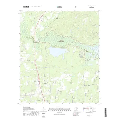
2019 Map of Redland
USGS Topo · Published 2019About this map
Lake Kurth and the northern edge of Lufkin anchor this landscape, where the waters of the Angelina River delineate the boundary between Angelina National Forest and Nacogdoches County. The area is characterized by a dense network of bayous and creeks, including Alazan Bayou and Black Bayou, which feed into the river system. Small communities like Redland, Davisville, and Moffitt are dispersed throughout the terrain, connected by rural routes such as FM 843 E and Old Ferry Rd. For those researching local heritage, the map identifies several burial sites including Walker Cem, Procella Cem, and Berry Cem. Landmarks like Shawnee Mineral Springs and Gravco Airport reflect the diverse historical uses of the land, from natural springs to early aviation infrastructure, while the eastern edge of the map shows the transition into the Sam Rayburn Reservoir basin.
Find a feature on this map
108 named features on this map. Tap any name to fly to it.
Don’t see what you’re looking for? This feature index may not catch every label — zoom into the map to look around manually.
Map Details
Editions of this 2019 Redland Map
This is the sole edition of this map. No revisions or reprints were ever made.
Other maps of this area

1949 · Lufkin
USGS Topo · 1:62,500

1949 · Platt
USGS Topo · 1:24,000

1949 · Clawson
USGS Topo · 1:24,000

1949 · Lufkin
USGS Topo · 1:24,000

1949 · Huntington
USGS Topo · 1:24,000

1949 · Keltys
USGS Topo · 1:24,000

1950 · Platt
USGS Topo · 1:24,000

1950 · Keltys
USGS Topo · 1:24,000

1950 · Lufkin
USGS Topo · 1:24,000

1950 · Clawson
USGS Topo · 1:24,000