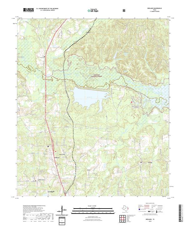
2022 Map of Redland
USGS Topo · Published 2022About this map
The Angelina National Forest dominates the upper reaches of this landscape, where the Angelina River winds through a complex network of wetlands including Board Tree Slough and the edge of the Sam Rayburn Reservoir. The terrain is marked by significant hydrological features like Shawnee Mineral Springs and Palisada Spring, suggesting a water-rich environment that historically shaped local settlement. Near the southern boundary, the city of Lufkin begins to transition into smaller outlying communities such as Redland, Davisville, and Moffitt. This area is particularly rich for genealogical research, with several family-named burial sites documented, including Procella Cem, Lang Cem, Walker Cem, and Cedar Grove Cem. Large water bodies like Lake Kurth and various creek systems like Paper Mill Cr and Mill Cr highlight the region's intersection of natural resources and industrial development.
Find a feature on this map
110 named features on this map. Tap any name to fly to it.
Don’t see what you’re looking for? This feature index may not catch every label — zoom into the map to look around manually.
Map Details
Editions of this 2022 Redland Map
This is the sole edition of this map. No revisions or reprints were ever made.
Other maps of this area

1949 · Lufkin
USGS Topo · 1:62,500

1949 · Platt
USGS Topo · 1:24,000

1949 · Clawson
USGS Topo · 1:24,000

1949 · Lufkin
USGS Topo · 1:24,000

1949 · Huntington
USGS Topo · 1:24,000

1949 · Keltys
USGS Topo · 1:24,000

1950 · Platt
USGS Topo · 1:24,000

1950 · Keltys
USGS Topo · 1:24,000

1950 · Lufkin
USGS Topo · 1:24,000

1950 · Clawson
USGS Topo · 1:24,000