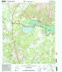
2003 Map of Redland
USGS Topo · Published 2004About this map
Angelina National Forest dominates the center of this landscape, where the Angelina River forms the boundary between Angelina and Nacogdoches counties. This survey reflects a region defined by its timber and water resources, evidenced by the presence of a Paper Mill and a substantial Aqueduct system near Kurth Lake. Small settlements and family landmarks are scattered throughout the piney woods, including Davisville and its associated Davisville Sta and Davisville Ch. Local genealogy is well-represented through several rural burial grounds such as Procella Cem, Walker Cem, and Berry Cem. Farther north, the landscape is segmented by numerous bayous, including Alazan Bayou and Loco Bayou, which feed into the primary river system. The presence of St James School and the community of Moffitt provides a clear view of the social geography in this East Texas forest belt during the early 21st century.
Find a feature on this map
34 named features on this map. Tap any name to fly to it.
Don’t see what you’re looking for? This feature index may not catch every label — zoom into the map to look around manually.
Map Details
Editions of this 2003 Redland Map
This is the sole edition of this map. No revisions or reprints were ever made.
Other maps of this area

1949 · Lufkin
USGS Topo · 1:62,500

1949 · Platt
USGS Topo · 1:24,000

1949 · Clawson
USGS Topo · 1:24,000

1949 · Lufkin
USGS Topo · 1:24,000

1949 · Huntington
USGS Topo · 1:24,000

1949 · Keltys
USGS Topo · 1:24,000

1950 · Platt
USGS Topo · 1:24,000

1950 · Keltys
USGS Topo · 1:24,000

1950 · Lufkin
USGS Topo · 1:24,000

1950 · Clawson
USGS Topo · 1:24,000