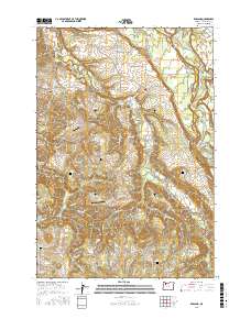
2017 Map of Redland
USGS Topo · Published 2017About this map
Clackamas River bends sharply through the northeast corner of this territory, where Eagle Creek and Goose Creek join the main flow near Paradise Park. The landscape is defined by the deep drainages of Clear Creek, Abernethy Creek, and Foster Creek, which carve through the plateau between the rural centers of Redland, Logan, and Viola. Notable for genealogists, the map identifies numerous family and community burial grounds, including Redland Cem, Viola Cem, and Moehnke Cemetery.
Find a feature on this map
109 named features on this map. Tap any name to fly to it.
Don’t see what you’re looking for? This feature index may not catch every label — zoom into the map to look around manually.
Map Details
Editions of this 2017 Redland Map
This is the sole edition of this map. No revisions or reprints were ever made.
Other maps of this area

1911 · Boring
USGS Topo · 1:48,000

1914 · Boring
USGS Topo · 1:62,500

1914 · Oregon City
USGS Topo · 1:62,500

1916 · Estacada
USGS Topo · 1:125,000

1939 · Molalla
USGS Topo · 1:62,500

1939 · Oregon City
USGS Topo · 1:62,500

1940 · Molalla
USGS Topo · 1:62,500

1940 · Boring
USGS Topo · 1:62,500

1941 · Oregon City
USGS Topo · 1:62,500

1948 · Vancouver
USGS Topo · 1:250,000