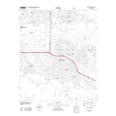
2012 Map of Redlands
USGS Topo · Published 2012About this map
Redlands and its surrounding communities sit at a major intersection of residential growth and natural drainage systems. The landscape is defined by the Santa Ana River and the engineered defenses of the Plunge Creek Levee, which protect various established neighborhoods like Lugonia Homes and University Village. Significant institutional footprints are visible, from the University of Redlands to the San Bernardino International Airport on the western edge. In the southern reaches, the terrain transitions into more dramatic topography, with Smiley Heights and Redlands Heights overlooking the San Timoteo Wash. This 2012 survey illustrates how modern development has integrated with older settlement points such as Lords Corner and Bryn Mawr, while preserving local heritage sites like Hillside Cem.
Find a feature on this map
117 named features on this map. Tap any name to fly to it.
Don’t see what you’re looking for? This feature index may not catch every label — zoom into the map to look around manually.
Map Details
Editions of this 2012 Redlands Map
This is the sole edition of this map. No revisions or reprints were ever made.
Other maps of this area

1896 · San Bernardino
USGS Topo · 1:62,500

1898 · San Bernardino
USGS Topo · 1:62,500

1899 · Redlands
USGS Topo · 1:62,500

1901 · Southern California Sheet No. 1
USGS Topo · 1:250,000

1901 · San Bernardino
USGS Topo · 1:62,500

1901 · Redlands
USGS Topo · 1:62,500

1901 · Elsinore
USGS Topo · 1:125,000

1901 · Riverside
USGS Topo · 1:62,500

1904 · Southern California Sheet No. 1
USGS Topo · 1:250,000

1936 · Arrowhead
USGS Topo · 1:31,680