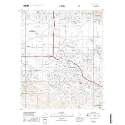
2018 Map of Redlands
USGS Topo · Published 2018About this map
Redlands and its surrounding communities are positioned at the base of the San Bernardino National Forest, where the irrigation systems of the Santa Ana River and The Mission Zanja transformed this arid valley into a center for the citrus industry. The landscape transitions from the urban core and the Univ of Redlands campus to the more industrial northern sectors, including San Bernardino and the San Bernardino International Airport. Historical land use is visible in the hills to the southwest, where the Coal Mine and Lower Coal Mine in Scott Canyon reflect early mineral extraction. To the east, the terrain rises toward Yucaipa and the San Jacinto Mountains, while the deep cut of San Timoteo Canyon provides a primary corridor for transportation and water drainage through the valley.
Find a feature on this map
67 named features on this map. Tap any name to fly to it.
Don’t see what you’re looking for? This feature index may not catch every label — zoom into the map to look around manually.
Map Details
Editions of this 2018 Redlands Map
This is the sole edition of this map. No revisions or reprints were ever made.
Other maps of this area

1896 · San Bernardino
USGS Topo · 1:62,500

1898 · San Bernardino
USGS Topo · 1:62,500

1899 · Redlands
USGS Topo · 1:62,500

1901 · Southern California Sheet No. 1
USGS Topo · 1:250,000

1901 · San Bernardino
USGS Topo · 1:62,500

1901 · Redlands
USGS Topo · 1:62,500

1901 · Elsinore
USGS Topo · 1:125,000

1901 · Riverside
USGS Topo · 1:62,500

1904 · Southern California Sheet No. 1
USGS Topo · 1:250,000

1936 · Arrowhead
USGS Topo · 1:31,680