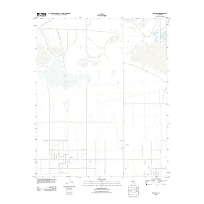
2012 Map of Redman
USGS Topo · Published 2012About this map
Redman serves as the focal point of this High Desert landscape, situated within a strict grid of agricultural and residential avenues in northern Los Angeles County. The community's social fabric is anchored by the Joshua Tree Grange, a significant local landmark for the surrounding farming district. To the north, the landscape shifts toward the vast playa of Buckhorn Lake, a topographic feature that highlights the arid character of the Antelope Valley. This area is heavily influenced by its proximity to military and aerospace operations, with the Edwards Air Force Sta spanning across the northern and eastern portions of the map. Major transit corridors like W Rosamond Blvd and Willow Springs Rd connect this remote pocket of the county to the wider Mojave region, while the meticulous numbering of roads such as 90th St E and E Avenue E illustrates the systematic organization of the California desert frontier.
Find a feature on this map
36 named features on this map. Tap any name to fly to it.
Don’t see what you’re looking for? This feature index may not catch every label — zoom into the map to look around manually.
Map Details
Editions of this 2012 Redman Map
This is the sole edition of this map. No revisions or reprints were ever made.
Other maps of this area

1915 · Elizabeth Lake
USGS Topo · 1:125,000

1917 · Elizabeth Lake
USGS Topo · 1:125,000

1930 · Joshua
USGS Topo · 1:24,000

1930 · Roosevelt School
USGS Topo · 1:24,000

1930 · Casa Desierta
USGS Topo · 1:24,000

1933 · Casa Desierta
USGS Topo · 1:24,000

1933 · Roosevelt School
USGS Topo · 1:24,000

1934 · Joshua
USGS Topo · 1:24,000

1937 · Rogers Lake
USGS Topo · 1:48,000

1942 · Rogers Lake
USGS Topo · 1:62,500