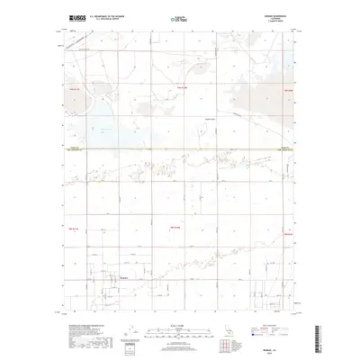
2018 Map of Redman
USGS Topo · Published 2018About this map
Redman occupies a central position within the arid expanse of the Mojave Desert along the border between Kern and Los Angeles counties. This 2018 survey details the highly structured grid of the Antelope Valley, where long thoroughfares like Rosamond Blvd, Lancaster Blvd, and Redman Rd intersect the landscape at precise intervals. The northern portion of the map is dominated by the alkaline floor of Buckhorn Lake, a notable geographic feature that influences the surrounding terrain. This modern cartographic record provides a clear view of the rural-to-suburban transition at the desert's edge, documenting the specific placement of numbered avenues and streets that define the local property boundaries and access routes in this part of Southern California.
Find a feature on this map
49 named features on this map. Tap any name to fly to it.
Don’t see what you’re looking for? This feature index may not catch every label — zoom into the map to look around manually.
Map Details
Editions of this 2018 Redman Map
This is the sole edition of this map. No revisions or reprints were ever made.
Other maps of this area

1915 · Elizabeth Lake
USGS Topo · 1:125,000

1917 · Elizabeth Lake
USGS Topo · 1:125,000

1930 · Joshua
USGS Topo · 1:24,000

1930 · Roosevelt School
USGS Topo · 1:24,000

1930 · Casa Desierta
USGS Topo · 1:24,000

1933 · Casa Desierta
USGS Topo · 1:24,000

1933 · Roosevelt School
USGS Topo · 1:24,000

1934 · Joshua
USGS Topo · 1:24,000

1937 · Rogers Lake
USGS Topo · 1:48,000

1942 · Rogers Lake
USGS Topo · 1:62,500