
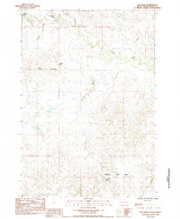
1959 Map of Redowl
USGS Topo · Published 1960About this map
Redowl and Stoneville anchor this mid-century topographic portrait of Meade County, where the plains are defined by an intricate network of seasonal drainages. The landscape is carved by the meandering paths of Red Owl Creek and White Owl Creek, illustrating the importance of water access in this high-prairie ranching country. The rural social fabric of the late 1950s is evidenced by the presence of North Red Owl Sch and Sunny Slope Sch, as well as the Pleasant View Cem, which serves as a central landmark for the local community.
Find a feature on this map
17 named features on this map. Tap any name to fly to it.
Don’t see what you’re looking for? This feature index may not catch every label — zoom into the map to look around manually.
Map Details
Editions of this 1959 Redowl Map
This is the sole edition of this map. No revisions or reprints were ever made.
Other maps of this area

1953 · Rapid City
USGS Topo · 1:250,000

1957 · Rapid City
USGS Topo · 1:250,000

1959 · Enning
USGS Topo · 1:24,000

1959 · Stoneville
USGS Topo · 1:24,000

1959 · Union Center
USGS Topo · 1:24,000

1983 · Whiteman Owl NW
USGS Topo · 1:24,000

1983 · Opal West SE
USGS Topo · 1:24,000

1983 · Whiteman Owl
USGS Topo · 1:24,000

1983 · Opal East SW
USGS Topo · 1:24,000
1983 · Big Draw
USGS Topo · 1:24,000