
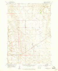
1959 Map of Union Center
USGS Topo · Published 1960About this map
Union Center serves as the primary hub in this late 1950s survey of eastern Meade County, showing a rural landscape defined by ranching and small-scale infrastructure. The presence of the South Pleasant View Sch in the northern portion of the quadrangle indicates the established, albeit sparse, community network of the era. The terrain is marked by a complex system of seasonal drainages, including East Elm Creek, West Bull Creek, and the long channel of Maddox Draw. These watercourses dictate the placement of ranch properties such as the M P Ranch near the northwestern corner. Local industry is represented by scattered Gravel Pits near the town center, while a small Levee reflects early water management efforts in this semi-arid region. This map is particularly valuable for tracing rural school districts and family ranch boundaries before many smaller holdings were consolidated or moved.
Find a feature on this map
9 named features on this map. Tap any name to fly to it.
Don’t see what you’re looking for? This feature index may not catch every label — zoom into the map to look around manually.
Map Details
Editions of this 1959 Union Center Map
This is the sole edition of this map. No revisions or reprints were ever made.
Other maps of this area

1953 · Hereford NE
USGS Topo · 1:24,000

1953 · Rapid City
USGS Topo · 1:250,000

1954 · Haydraw
USGS Topo · 1:24,000

1954 · Boneita Springs
USGS Topo · 1:24,000

1957 · Rapid City
USGS Topo · 1:250,000

1959 · Fairpoint
USGS Topo · 1:24,000

1959 · Enning
USGS Topo · 1:24,000

1959 · Redowl
USGS Topo · 1:24,000

1959 · Stoneville
USGS Topo · 1:24,000
1959 · Fairpoint SE
USGS Topo · 1:24,000