
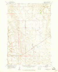
1953 Map of Hereford NE
USGS Topo · Published 1955About this map
North Star Sch and Reichert Sch stand as the primary community landmarks in this 1953 landscape, highlighting the rural educational network of Meade County at mid-century. The terrain is defined by the drainage systems of Elm Creek and its tributary, East Elm Creek, which carve deep, branching draws into the high plains. In the northeast corner, Hay Creek passes through a flatter section of the territory, where the map reveals a pattern of section lines and small reservoirs supporting isolated ranching operations. The intricate contour lines illustrate a rugged topography often referred to locally as the Cross, where erosion has created a complex web of ridges and valleys that dictated the placement of early roads and schoolhouses.
Find a feature on this map
6 named features on this map. Tap any name to fly to it.
Don’t see what you’re looking for? This feature index may not catch every label — zoom into the map to look around manually.
Map Details
Editions of this 1953 Hereford NE Map
This is the sole edition of this map. No revisions or reprints were ever made.
Other maps of this area

1953 · Hereford SE
USGS Topo · 1:24,000

1953 · Hereford
USGS Topo · 1:24,000

1953 · Hereford SW
USGS Topo · 1:24,000

1953 · Rapid City
USGS Topo · 1:250,000

1954 · Elm Springs SW
USGS Topo · 1:24,000

1954 · Haydraw
USGS Topo · 1:24,000

1957 · Rapid City
USGS Topo · 1:250,000

1959 · Fairpoint SW
USGS Topo · 1:24,000

1959 · Union Center
USGS Topo · 1:24,000
1959 · Fairpoint SE
USGS Topo · 1:24,000