
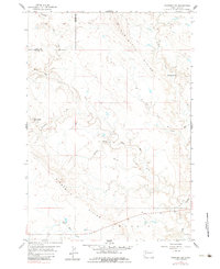
1959 Map of Fairpoint SW
USGS Topo · Published 1960About this map
Elm Butte Divide and Cross Divide define the high ground in this sparsely populated stretch of western South Dakota at the close of the 1950s. The landscape is characterized by a dendritic drainage network where seasonal waters flow through channels like Eightmile Creek, Crooked Creek, and Lone Tree Creek. Human activity is concentrated around established cattle operations, notably the Chaffee Ranch in the east and Glenn Ranch to the west, reflecting the area's deep-rooted ranching economy. The border between Butte and Meade Counties bisects the northern sections, cutting through the high ridges. Topographical details reveal a complex system of draws and breaks, including Browns Draw and the various branches of the Elm Creek system such as West Elm Creek and Dry Elm Creek.
Find a feature on this map
12 named features on this map. Tap any name to fly to it.
Don’t see what you’re looking for? This feature index may not catch every label — zoom into the map to look around manually.
Map Details
Editions of this 1959 Fairpoint SW Map
2 editions found
Other maps of this area

1893 · Rapid
USGS Topo · 1:125,000

1898 · Rapid
USGS Topo · 1:125,000

1903 · Rapid
USGS Topo · 1:125,000

1913 · Newell
USGS Topo · 1:125,000

1951 · Volunteer SE
USGS Topo · 1:24,000

1953 · Hereford
USGS Topo · 1:24,000

1953 · Rapid City 1 NE
USGS Topo · 1:24,000

1953 · Hereford NE
USGS Topo · 1:24,000

1953 · Rapid City
USGS Topo · 1:250,000

1957 · Rapid City
USGS Topo · 1:250,000