
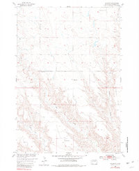
1954 Map of Haydraw
USGS Topo · Published 1956About this map
The small settlement of Haydraw serves as the focal point for this mid-century survey of Meade County, South Dakota. Documenting the landscape during the 1950s development of the Missouri River Basin, the map illustrates a rural network of schoolhouses that once anchored the local community. These include Union Center Sch in the north and Prairie Sch, while the presence of the Barry Sch (Abandoned) suggests early shifts in the region's educational geography.
Find a feature on this map
8 named features on this map. Tap any name to fly to it.
Don’t see what you’re looking for? This feature index may not catch every label — zoom into the map to look around manually.
Map Details
Editions of this 1954 Haydraw Map
2 editions found
Other maps of this area

1953 · Hereford SE
USGS Topo · 1:24,000

1953 · Hereford NE
USGS Topo · 1:24,000

1953 · Rapid City
USGS Topo · 1:250,000

1954 · Elm Springs SW
USGS Topo · 1:24,000

1954 · Elm Springs
USGS Topo · 1:24,000

1954 · Boneita Springs
USGS Topo · 1:24,000

1957 · Rapid City
USGS Topo · 1:250,000

1959 · Enning
USGS Topo · 1:24,000

1959 · Union Center
USGS Topo · 1:24,000
1959 · Fairpoint SE
USGS Topo · 1:24,000