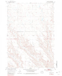
1954 Map of Haydraw
USGS Topo · Published 1981About this map
Haydraw serves as the focal point of this rural Meade County landscape, where the settlement and the nearby Haydraw Cem anchor a sparsely populated expanse of prairie and draws. The map illustrates a mid-century educational network, showing several local schoolhouses spaced across the terrain, including Union Center Sch, Prairie Sch, and the already Barry Sch (Abandoned).
Find a feature on this map
10 named features on this map. Tap any name to fly to it.
Don’t see what you’re looking for? This feature index may not catch every label — zoom into the map to look around manually.
Map Details
Editions of this 1954 Haydraw Map
2 editions found
Other maps of this area

1953 · Hereford SE
USGS Topo · 1:24,000

1953 · Hereford NE
USGS Topo · 1:24,000

1953 · Rapid City
USGS Topo · 1:250,000

1954 · Elm Springs SW
USGS Topo · 1:24,000

1954 · Haydraw
USGS Topo · 1:24,000

1954 · Elm Springs
USGS Topo · 1:24,000

1954 · Boneita Springs
USGS Topo · 1:24,000

1957 · Rapid City
USGS Topo · 1:250,000

1959 · Enning
USGS Topo · 1:24,000

1959 · Union Center
USGS Topo · 1:24,000