
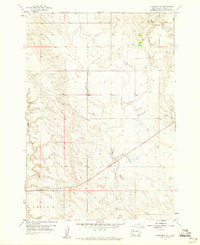
1959 Map of Fairpoint
USGS Topo · Published 1960About this map
Fairpoint anchors this high-plains landscape in Meade County during the late 1950s, serving as a focal point for a remote ranching and farming community. The topography is defined by the winding drainages of Soft Water Creek in the north and the deeply etched path of Coyote Creek through the central and southern reaches. Small-scale institutional landmarks such as the Atall Sch and the Fairpoint Cem reflect the sparse but deliberate settlement pattern typical of the South Dakota prairie during this era. A local Gravel Pit suggests the ongoing maintenance of the unimproved dirt road network that connects these isolated homesteads and schools across the undulating terrain.
Find a feature on this map
7 named features on this map. Tap any name to fly to it.
Don’t see what you’re looking for? This feature index may not catch every label — zoom into the map to look around manually.
Map Details
Editions of this 1959 Fairpoint Map
This is the sole edition of this map. No revisions or reprints were ever made.
Other maps of this area

1953 · Rapid City
USGS Topo · 1:250,000

1957 · Rapid City
USGS Topo · 1:250,000

1959 · Fairpoint SW
USGS Topo · 1:24,000

1959 · Stoneville
USGS Topo · 1:24,000

1959 · Union Center
USGS Topo · 1:24,000

1959 · Fairpoint NW
USGS Topo · 1:24,000
1959 · Fairpoint SE
USGS Topo · 1:24,000

1977 · Table Top Butte
USGS Topo · 1:24,000

1978 · Bull Run Creek
USGS Topo · 1:24,000
1983 · Big Draw
USGS Topo · 1:24,000