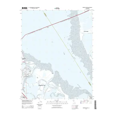
2015 Map of Redwood Point
USGS Topo · Published 2015About this map
San Francisco Bay dominates this map, serving as the central divide between the Peninsula and the East Bay shoreline. The landscape is defined by the intricate transition from deep water to the complex marshlands and sloughs that characterize the South Bay. On the western shore, the planned community of Redwood Shores sits north of Redwood City, featuring a modern network of residential streets such as Mindanao Dr and Mediterranean Dr built around artificial lagoons. Extensive natural features remain preserved in the bay, including the sprawling Greco Island and Bair Island, which are separated by Smith Slough. To the east, the shoreline of Hayward is accessed by the San Mateo Bridge, while the Dumbarton Bridge anchors the southern reaches of the frame. This survey highlights the mid-2010s balance between Silicon Valley's urban expansion and the tidal habitats that line its waterfront.
Find a feature on this map
38 named features on this map. Tap any name to fly to it.
Don’t see what you’re looking for? This feature index may not catch every label — zoom into the map to look around manually.
Map Details
Editions of this 2015 Redwood Point Map
This is the sole edition of this map. No revisions or reprints were ever made.
Other maps of this area

1892 · San Mateo
USGS Topo · 1:62,500

1896 · San Mateo
USGS Topo · 1:62,500

1897 · Palo Alto
USGS Topo · 1:62,500

1899 · Palo Alto
USGS Topo · 1:62,500

1899 · Haywards
USGS Topo · 1:62,500

1899 · San Mateo
USGS Topo · 1:62,500

1902 · Santa Cruz
USGS Topo · 1:125,000

1915 · San Mateo
USGS Topo · 1:62,500

1915 · Haywards
USGS Topo · 1:62,500

1939 · San Mateo
USGS Topo · 1:62,500