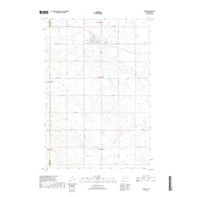
2018 Map of Reeder
USGS Topo · Published 2018About this map
Reeder serves as the focal point of this southwestern North Dakota landscape, situated along a prominent east-west transportation corridor. The town layout is defined by its agricultural and residential grid, featuring Elevator St and several primary thoroughfares such as 2nd St and 8th Ave NW. Just to the southeast of the main settlement lies Rose Hill Cem, a significant site for local genealogical research. The surrounding terrain is characterized by the meandering path of Buffalo Cr, which cuts through the prairie landscape to the south and west. This area near the Bowman and Adams county line is primarily defined by its section-line road network, reflecting the systematic land division of the Great Plains. The map also details the course of Hwy 22 S as it travels south through the rural township, providing a clear picture of the region's modern infrastructure and drainage patterns.
Find a feature on this map
22 named features on this map. Tap any name to fly to it.
Don’t see what you’re looking for? This feature index may not catch every label — zoom into the map to look around manually.
Map Details
Editions of this 2018 Reeder Map
This is the sole edition of this map. No revisions or reprints were ever made.
Other maps of this area

1935 · Reva
USGS Topo · 1:125,000

1953 · Dickinson
USGS Topo · 1:250,000

1954 · Lemmon
USGS Topo · 1:250,000

1957 · Dickinson
USGS Topo · 1:250,000

1957 · Lemmon
USGS Topo · 1:250,000

1968 · Haley
USGS Topo · 1:24,000

1969 · Gascoyne
USGS Topo · 1:24,000

1969 · Reeder
USGS Topo · 1:24,000

1969 · Scranton NE
USGS Topo · 1:24,000

1974 · Cow Butte
USGS Topo · 1:24,000