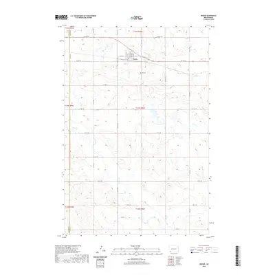
2020 Map of Reeder
USGS Topo · Published 2020About this map
Reeder serves as the central hub of this Adams County landscape, situated along the northern edge of the map. The town's grid is clearly defined by landmarks such as Elevator St and several primary avenues, including 1st Ave E and 2nd Ave E. South of the town center, the Rose Hill Cem provides a significant touchstone for genealogists and local historians researching the early families of the region. The surrounding terrain is defined by the winding course of Buffalo Cr, which meanders through the southern townships. A strict section-line road network, featuring numbered routes like 16th St NW and 5th Ave NW, illustrates the systematic land division typical of the Great Plains. The western edge of the map identifies the boundary between Bowman Co and Adams Co.
Find a feature on this map
32 named features on this map. Tap any name to fly to it.
Don’t see what you’re looking for? This feature index may not catch every label — zoom into the map to look around manually.
Map Details
Editions of this 2020 Reeder Map
This is the sole edition of this map. No revisions or reprints were ever made.
Other maps of this area

1935 · Reva
USGS Topo · 1:125,000

1953 · Dickinson
USGS Topo · 1:250,000

1954 · Lemmon
USGS Topo · 1:250,000

1957 · Dickinson
USGS Topo · 1:250,000

1957 · Lemmon
USGS Topo · 1:250,000

1968 · Haley
USGS Topo · 1:24,000

1969 · Gascoyne
USGS Topo · 1:24,000

1969 · Reeder
USGS Topo · 1:24,000

1969 · Scranton NE
USGS Topo · 1:24,000

1974 · Cow Butte
USGS Topo · 1:24,000