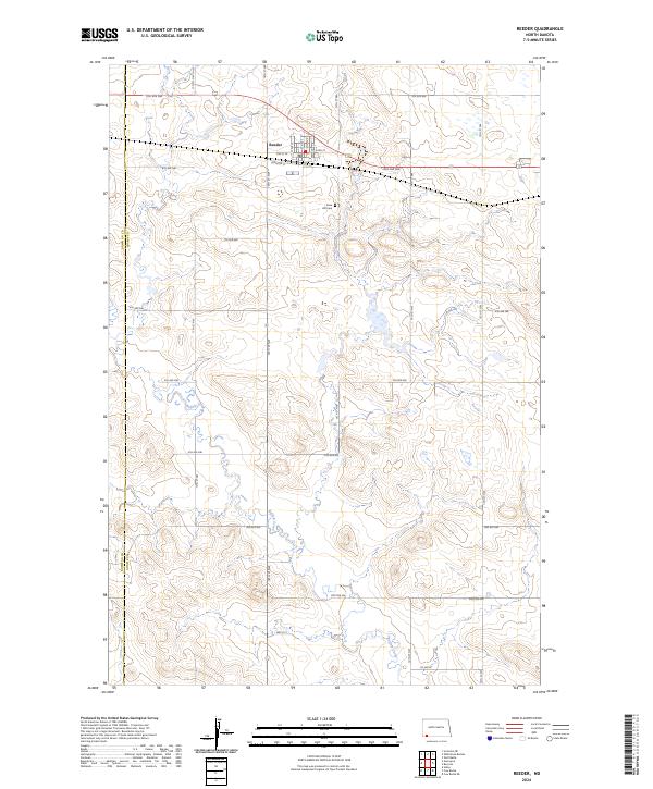
2024 Map of Reeder
USGS Topo · Published 2024About this map
The community of Reeder stands as a focal point in this portion of the northern plains, organized along a strict grid near the crossing of Elevator St and several numbered avenues. This layout, combined with the presence of Rose Hill Cem to the southeast, reflects a settled landscape defined by early 20th-century agricultural expansion. The terrain is marked by the winding course of Buffalo Creek, which meanders south through the townships, providing a natural break in the geometric section lines that dominate the topography. The boundary between Bowman Co and Adams Co runs vertically along the western edge of the sheet, illustrating how political lines were overlaid on this undulating prairie landscape. Local travel is facilitated by a network of rural roads such as Hwy 22 S, which cuts across the southern sections of the township.
Find a feature on this map
26 named features on this map. Tap any name to fly to it.
Don’t see what you’re looking for? This feature index may not catch every label — zoom into the map to look around manually.
Map Details
Editions of this 2024 Reeder Map
This is the sole edition of this map. No revisions or reprints were ever made.
Other maps of this area

1935 · Reva
USGS Topo · 1:125,000

1953 · Dickinson
USGS Topo · 1:250,000

1954 · Lemmon
USGS Topo · 1:250,000

1957 · Dickinson
USGS Topo · 1:250,000

1957 · Lemmon
USGS Topo · 1:250,000

1968 · Haley
USGS Topo · 1:24,000

1969 · Gascoyne
USGS Topo · 1:24,000

1969 · Reeder
USGS Topo · 1:24,000

1969 · Scranton NE
USGS Topo · 1:24,000

1974 · Cow Butte
USGS Topo · 1:24,000