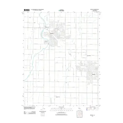
2012 Map of Reedley
USGS Topo · Published 2012About this map
Reedley and Dinuba anchor this agricultural corridor in the San Joaquin Valley, where the Kings River flows south past Reedley Beach and the Kings River Community College Airport. The landscape is a rigid grid of orchards and vineyards, partitioned by an intricate network of irrigation channels including the West Reedley Ditch, Travers Cr, and A H Smith Ditch. These waterworks define the rural character of the area, supporting established settlements like Delft Colony and smaller stops such as Lacjac and Ivory. Local history is preserved at the Reedley Cem and the SDA Cem, while the town centers show the modern density of these Central Valley communities. The map provides a detailed view of the infrastructure that sustains this productive region, from the winding riverbanks to the perfectly straight roads of North Dinuba.
Find a feature on this map
79 named features on this map. Tap any name to fly to it.
Don’t see what you’re looking for? This feature index may not catch every label — zoom into the map to look around manually.
Map Details
Editions of this 2012 Reedley Map
This is the sole edition of this map. No revisions or reprints were ever made.
Other maps of this area

1921 · Squaw Valley
USGS Topo · 1:31,680

1922 · Trimmer
USGS Topo · 1:96,000

1923 · Sultana
USGS Topo · 1:31,680

1923 · Wahtoke
USGS Topo · 1:31,680

1923 · Sanger
USGS Topo · 1:31,680

1924 · Reedley
USGS Topo · 1:31,680

1924 · Selma
USGS Topo · 1:31,680

1924 · Citrus Cove
USGS Topo · 1:31,680

1924 · Dinuba
USGS Topo · 1:125,000

1926 · Burris Park
USGS Topo · 1:31,680