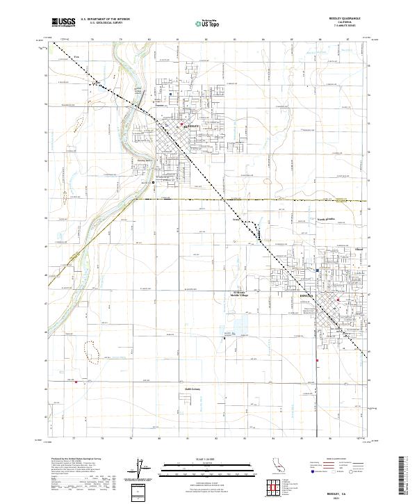
2021 Map of Reedley
USGS Topo · Published 2021About this map
The Kings River winds along the western edge of Reedley, serving as a natural boundary between Fresno and Tulare counties. This landscape is defined by an intricate network of irrigation infrastructure, including the Smith Ferry Canal, Buttonwillow Ditch, and Dinuba Town Ditch, reflecting the region's intensive agricultural character. Small residential and industrial clusters such as Lacjac, Ivory, and Delft Colony are interspersed among the larger centers of Dinuba and Reedley. Educational and civic life is centered at the Reedley College campus and the nearby Reedley College Airport. For those tracing local heritage, the map identifies several significant landmarks including the Reedley Cem and the Seventh - Day Adventist Cem, alongside the Tulare County Superior Court - Dinuba Division located in the southern portion of the survey area.
Find a feature on this map
111 named features on this map. Tap any name to fly to it.
Don’t see what you’re looking for? This feature index may not catch every label — zoom into the map to look around manually.
Map Details
Editions of this 2021 Reedley Map
This is the sole edition of this map. No revisions or reprints were ever made.
Other maps of this area

1921 · Squaw Valley
USGS Topo · 1:31,680

1922 · Trimmer
USGS Topo · 1:96,000

1923 · Sultana
USGS Topo · 1:31,680

1923 · Wahtoke
USGS Topo · 1:31,680

1923 · Sanger
USGS Topo · 1:31,680

1924 · Reedley
USGS Topo · 1:31,680

1924 · Selma
USGS Topo · 1:31,680

1924 · Citrus Cove
USGS Topo · 1:31,680

1924 · Dinuba
USGS Topo · 1:125,000

1926 · Burris Park
USGS Topo · 1:31,680