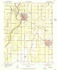
1949 Map of Reedley
USGS Topo · Published 1958About this map
The Kings River defines the western edge of this agricultural landscape, where the boundary between Fresno and Tulare counties follows the river's winding course. This late 1940s survey reveals a dense grid of fruit orchards and vineyards supported by an intricate irrigation network including the Traver Canal and California Vineyard Ditch. The towns of Reedley and Dinuba serve as the primary hubs, each anchored by the competing lines of the Southern Pacific and the Atchison Topeka and Santa Fe railroads.
Find a feature on this map
77 named features on this map. Tap any name to fly to it.
Don’t see what you’re looking for? This feature index may not catch every label — zoom into the map to look around manually.
Map Details
Editions of this 1949 Reedley Map
This is the sole edition of this map. No revisions or reprints were ever made.
Other maps of this area

1921 · Squaw Valley
USGS Topo · 1:31,680

1922 · Trimmer
USGS Topo · 1:96,000

1923 · Sultana
USGS Topo · 1:31,680

1923 · Wahtoke
USGS Topo · 1:31,680

1923 · Sanger
USGS Topo · 1:31,680

1924 · Reedley
USGS Topo · 1:31,680

1924 · Selma
USGS Topo · 1:31,680

1924 · Citrus Cove
USGS Topo · 1:31,680

1924 · Dinuba
USGS Topo · 1:125,000

1926 · Burris Park
USGS Topo · 1:31,680