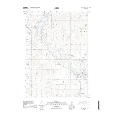
2018 Map of Reedsburg West
USGS Topo · Published 2018About this map
Lake Redstone dominates the northern reaches of this Sauk County landscape, its irregular shoreline reaching into many narrow valleys. To the south, the Baraboo River meanders through a broad valley toward the settlement of Reedsburg, while La Valle sits along the river's western course. The map documents a landscape defined by significant elevation changes, from the prominent Kinnamon Ridge and Thieman Hill to the flat expanse of Babbs Prairie. Genealogists will find several burial sites recorded across the township, including Saint Patricks Cem, Babb Cem, and Resting Green Cem. Distinctive geological features like Lighthouse Rock and the North Range provide further landmarks for those studying the natural and cultural boundaries of the region. The drainage patterns of Silver Cr, Twin Cr, and Babb Cr illustrate how water has shaped the local topography and settlement patterns over time.
Find a feature on this map
101 named features on this map. Tap any name to fly to it.
Don’t see what you’re looking for? This feature index may not catch every label — zoom into the map to look around manually.
Map Details
Editions of this 2018 Reedsburg West Map
This is the sole edition of this map. No revisions or reprints were ever made.
Other maps of this area

1901 · Denzer
USGS Topo · 1:62,500

1901 · The Dells
USGS Topo · 1:62,500

1905 · Richland Center
USGS Topo · 1:125,000

1956 · Reedsburg
USGS Topo · 1:62,500

1957 · Wisconsin Dells
USGS Topo · 1:62,500

1957 · Madison
USGS Topo · 1:250,000

1958 · North Freedom
USGS Topo · 1:62,500

1958 · La Crosse
USGS Topo · 1:250,000

1960 · Madison
USGS Topo · 1:250,000

1960 · Plain
USGS Topo · 1:62,500