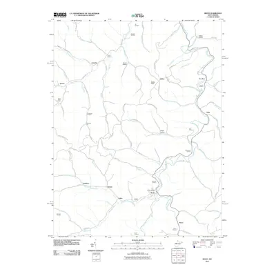
2011 Map of Reedy
USGS Topo · Published 2011About this map
Reedy Creek and its many tributaries, including Right Fork Reedy Creek and Middle Fork Reedy Creek, carve through the complex ridge-and-hollow terrain of Roane County. This landscape is defined by its numerous small family and community burial grounds, such as Center Valley Cemetery and Board Cemetery, which anchor the histories of the surrounding settlements. Small rural centers like Reedy—home to the Reedy Post Office—and Lucile sit along winding roads like Liverpool, while smaller locales such as Peewee, Zackville, and Seaman are tucked away near specific watercourses and ridges. The naming of terrain features like Buffalo Hollow, Sam Shapero Ridge, and Frog Holler reflects a deeply localized geography where every ridge and run carries a distinct identity.
Find a feature on this map
89 named features on this map. Tap any name to fly to it.
Don’t see what you’re looking for? This feature index may not catch every label — zoom into the map to look around manually.
Map Details
Editions of this 2011 Reedy Map
This is the sole edition of this map. No revisions or reprints were ever made.
Other maps of this area

1906 · Elizabeth
USGS Topo · 1:62,500

1906 · Belleville
USGS Topo · 1:62,500

1907 · Spencer
USGS Topo · 1:62,500

1907 · Ripley
USGS Topo · 1:62,500

1924 · Belleville
USGS Topo · 1:62,500

1924 · Elizabeth
USGS Topo · 1:62,500

1926 · Elizabeth
USGS Topo · 1:62,500

1926 · Belleville
USGS Topo · 1:62,500

1926 · Ripley
USGS Topo · 1:62,500

1928 · Spencer
USGS Topo · 1:62,500